Württemberg Geography
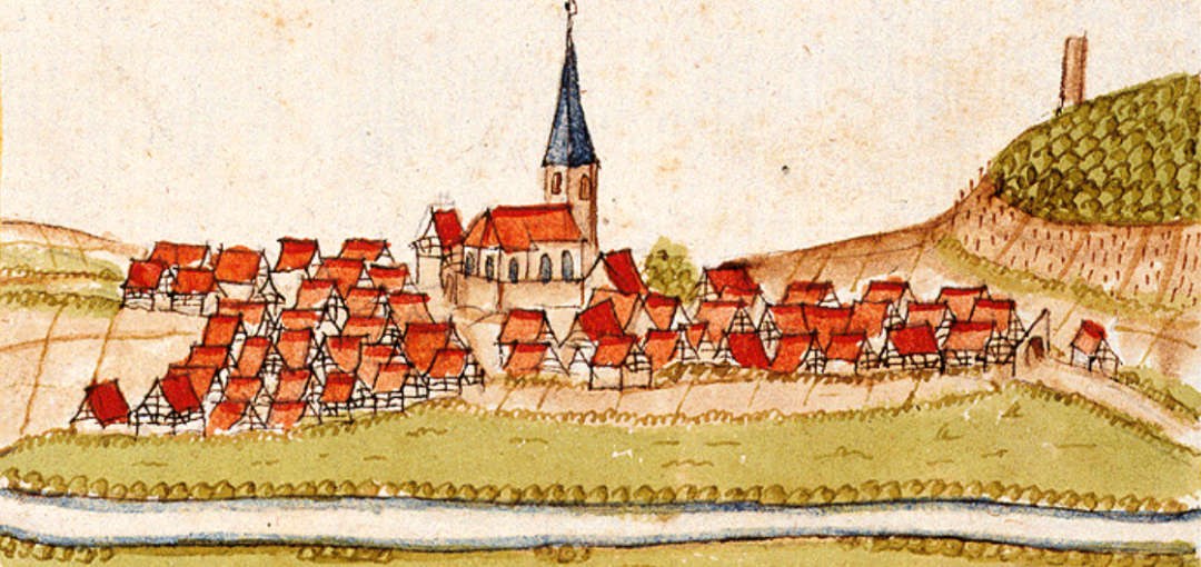
As we continue to explore the early history of our German ancestors, we have tried to wrap our minds around the geography of the region they lived in during the 17th and 18th centuries. This was touched upon in the recent article “Plagues, Wars and Despair.” It would be much easier to understand the areas that Andreas Hagenbuch (b. 1715) and his family lived in from 1652 to 1737 if we could travel the roads from village to village as they once were.
For example, a few weeks ago Linda and I traveled through Northumberland and Montour counties to place Christmas wreaths on her parents’ and my parents’ graves. Since I grew up in that area I took mostly back roads, enjoying the ride and remembering these areas from almost 70 years ago. If only we could look through Andreas’ eyes and visit the German area he grew up in.
In 1652, it is reported that Andreas Hagenbuch’s great grandparents, Hans Jacob Sr. (b. 1620) and Barbara (Bucher) Hagenbuch (b. 1616), moved from Switzerland to Cleebronn, in what is now southern Germany. It is also reported that Andreas was born and baptized in Grossgartach in March of 1715. Grossgartach is now called Leingarten which is located five miles west of the city of Heilbronn, Germany. Cleebronn is about 9.5 miles south of Leingarten. For another perspective, Cleebronn is located about 15.5 miles northwest of the city of Ludwigsburg. Here is a Google Maps link showing the location of Leingarten.
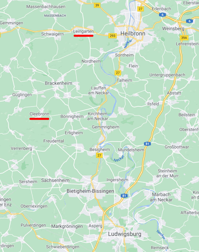
Map of a portion of Germany. Leingarten (Grossgartach) and Cleebronn are underlined in red. Credit: Google Maps
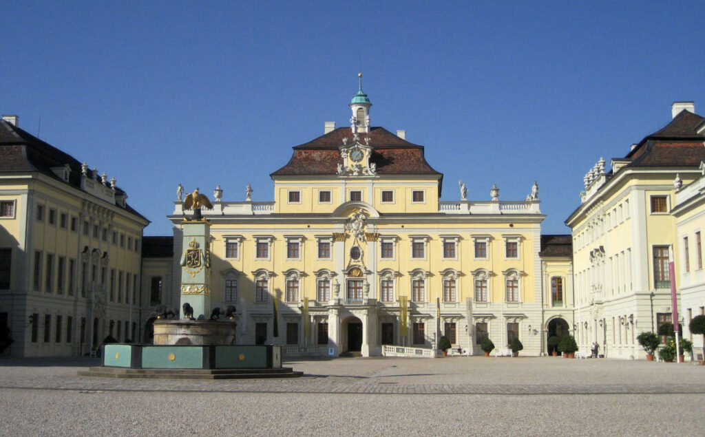
During the 17th and 18th centuries there was no unified country of Germany. The towns and cities mentioned above were located within the Duchy of Württemberg, now the German state of Baden-Württemberg. Germany, as we know it today, was made up of several Duchies ruled by the Holy Roman Emperor. During most of the years that Andreas and his ancestors lived in Württemberg, it was ruled by Duke William Louis and his son Duke Eberhard Louis. It was Duke Eberhard who built the beautiful Ludwigsburg Palace in 1711. Funding its construction required money, as did the wars that had ravaged the area (the Thirty Years’ War and the Nine Years’ War) and the black plague in the 17th century. Therefore, taxes skyrocketed in the early 18th century for the people of Württemberg.
Interestingly, I have traveled in this area. In 1977 and 1979, my wife and I visited her sister and family who lived in the village of Ingersheim which is 6 miles north of Ludwigsburg. Little did I know that I was probably traveling on the roads that my ancestors used; nor did I know that the villages in this area were known by my Hagenbuch family 300 years earlier. Of course, some of the highways and byways have changed from that time and the look of the land certainly changed too.
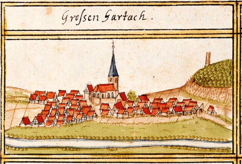
There are visual records of some of the villages from the 17th century. One of these images is of Cleebronn created by Andreas Kieser which was featured in the article “Plagues, Wars and Despair.” After the devastating wars and destruction by the French and Spanish, the villages would have looked somewhat different than when Andreas Kieser created his cartoon-like illustrations in 1684 for the “forest register books.” Little can be found out about these prints, but they give an interesting view of what the villages looked like after the Thirty Years’ War and immediately before the Nine Year’s War.
Kieser’s print of Cleebronn depicts a quaint village overshadowed by the Magenheim Castle. His print of Grossgartach shows that it lies beside the river Lein which is a tributary of the Neckar River, a main thoroughfare for transporting goods in this part of Germany. Partially fortified in 1684, Kieser depicts St. Lorenz protestant church where Andreas was most likely baptized on March 16, 1715, the day after he was born. This would be classified an “emergency baptism” which indicates Andreas may not have been expected to live. Thanks be to God he did! Grossgartach and the neighboring town of Schluchtern grew together, merging in 1970 to form Leingarten.
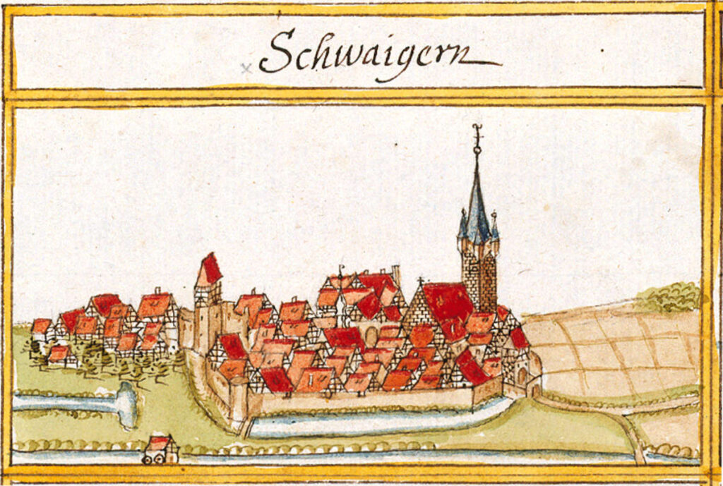
Two more of Kieser’s depictions from 1684 need to be mentioned. Schwaigern, located only four miles west of Grossgartach (Leingarten), was a walled town in 1684. In 1630, much of the town’s population was wiped out by the black plague. Then in 1690 as the French lay waste to this part of Germany, the castle at Schwaigern was destroyed. Our Hagenbuch ancestors living so close to this town would certainly have been affected by this devastation.
Years ago, early on in my research, I was given information by a German genealogist that Andreas had been living in the town of Lomersheim before coming to America in 1737. We are still not sure about this, but it is certainly possible. Lomersheim is located next to the city of Mühlacker which is 20 miles southwest of Cleebronn. This is also where distant cousin Ulrich Hagenbuch lives today. Lomersheim is bordered by the river Enz which flows into the Neckar. Andreas Kieser’s depiction of Lomersheim not only shows the Enz but also St. Peter’s church, the Peterskirche, which still survives today.
To put everything into perspective, Lomersheim and Leingarten are about 25 miles apart with Cleebronn located almost in the middle. Our Hagenbuch ancestors could easily have day-walked between these towns and would have been familiar with all the roads, streams, walkways, and rivers. Finally, when Andreas Hagenbuch left this area of Württemberg in the spring of 1737 with his second wife Maria Magdalena (Schumtz) and his one-year-old son Henry, they may have traveled on the Neckar River to the Rhine River and from there to Rotterdam, Netherlands on their way to America.
How often must Andreas have thought back to the 22 years he lived as a young man in and nearby the villages written about in this article. Whereas Andreas’ 18th century America was different than his 18th century Württemberg, he called both areas home. So, it is important that we understand the geography of the Duchy of Württemberg as we have studied the various areas of Berks County, Pennsylvania.

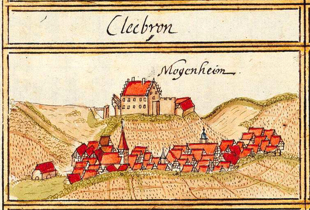










Great historic-geographic overview, with great illustrations. I notice all the houses illustrated are Fachwerk (half-timber) construction. The expression “square peg in a round hole” originated with the method of joining the stout oak timbers: a hole was bored through the two timbers, one with a slot and one with a tongue to fit into the slot, then a square oak peg was driven through the aligned holes by mallet blows to assure a tight fit.
THANKS, Jean. We appreciate your message……Mark
Thanks guys for another great and informative article. How would Andreas have travelled from one village to another? I sometimes dream of what a typical winter morning might have been like in Philadelphia before the Revolution. So cold with horses going by the front windows, The history of the period’s carriages is a great topic to explore. Mayor Samuel Powel (who died of a mosquito bite/yellow fever…his period’s Covid) had a handsome one that is now in the collection at Mt. Vernon. And, Benjamin Chew may have had the best. In keeping up with the Jones, most of them were imported from London on custom order….including Washington’s! Now to check your raisin bread!
Hello…..I have often thought the same thing. Did Andreas and his family have any horses, or even just one horse?, maybe a cart, but I’m sure not a coach. I am sure there was a lot of walking. You know we did publish a story about Samuel Powel’s house which was built by Charles Stedman, the captain of ship “Charming Nancy” that Andreas was on to America. I have been inside the Chew house, Cliveden, several times, as a British reenactor, even shot my musket out of the upper windows at the “Rebels” in the recreated Battle of Germantown. THANKS for your message.